Velo Course: Mountains to Sea via the SGRT...
The San Gabriel River Trail (SGRT) is one of three great river trails in the region. Two of these, the SGRT and the Santa Ana River Trail (SART) are complete bikeways stretching from the mountains to the coast. They are popular and well-used each day of the week, year-beginning to year-end. Even well known, heavily ridden routes can be part of the Velo course.
There was a time when I avoided off-street bike paths like the SGRT as if they were a source of the plague. Too many weekend riders not paying attention, too many pedestrians making sudden changes in direction, dogs on extenda-leashes, or worse yet no leash at all, led to too many close calls. But I learned to anticipate potential problems and take precautions, and bike paths gradually became more acceptable. Plus, they have certain advantages; such as no competition for space with motorized vehicles. In my opinion their greatest advantage, though, is the ability to ride as many miles as you want, or can stand, without stopping. Bike paths like this are pretty sanitized, not a lot of challenge to them; topographically they are about as close to board flat as you can get. What they do offer is mile after mile of non-stop riding, and in the case of the SGRT, that means seventy-six miles of start to finish cycling spin.

at the northern end of the path, the San Gabriel Mountains are a dramatic backdrop

the big sweep of the Santa Fe Dam
The SGRT has been a part of my route repertoire for about twenty years. There have been a lot of changes over that time, usually a combination of aesthetic and functional, which have led to the path becoming a significant recreational destination, as well as transportation corridor every day of the week. The two ends of the path - the Santa Fe Dam Recreation Area and Seal Beach - are, naturally, the busiest parts, but you are rarely out of sight of another cyclist, runner, walker, or equestrian anywhere along its length. Other heavy use areas are at Whittier Narrows, and along the parks in the Downey / Cerritos / Artesia area.
The SGRT is basically a long straight shot from mountains to sea. Yes, there are big sweeping turns of the river channel that you follow but, for the most part, there is not a lot of change in direction. If you start at the mountain end of the path this fact generally works in your favor; prevailing wind patterns move from coast to mountains, so you may have some headwind to beat into moving down river, but coming back up it becomes a glorious tailwind. This wind/breeze pattern is most evident the closer you get to the coast, and can really knock your speed down, or pick it up, depending on which way you are traveling.
This is a route that could get rather tedious if not for the shift in views along either side of you. One minute you are moving through an area of light industry, then open space of deep quarry pits, followed by residential neighborhoods broken by a string of schools, and back to open parkland. Turn your head from side to side, focus your eyes far away, then narrow your vision for an up-close view; you never know what point of interest might pop into the scene. Anything from vaqueros riding along in big sombreros, people fishing in the river at Whittier Narrows, rest areas landscaped with California native plants, Canada geese and all kinds of waterfowl. Believe it or not, I even saw a fish once, trapped in a rapidly drying section of river, splashing its last as the river shrank around it. I have seen congregations of Turkey Vultures, their pates growing more red by the minute in the summer sun. There are herons and egrets. There is the rooster ranch at the Narrows; why so many roosters are in one place I don't know. In the same area you will notice the decorative gates depicting riverine scenes. A little further along, right were the river channel becomes concrete, the California Highway Patrol (CHP) often holds motorcycle drills in the channel - orange cones set up in obstacle course fashion. Even further downriver, nearer to the coast, you may hear the sound of gun fire. Not to worry though, they are coming from a multi-agency shooting range just off the path. There are plenty of old rusting railroad bridges to see, and often trains as well. Down near the coast, where the river becomes soft-bottomed again look for the pyramid at California State University, Long Beach. If you are lucky, and have timed things right, you might get to witness a tidal bore making its way upriver. They are nothing like what you might see in other areas of the world, but are clear enough that you will know it when you see it.

watch for small points of interest
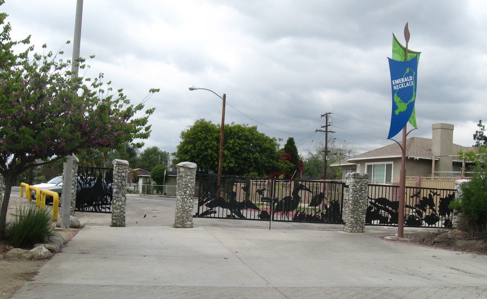
one of the decorative fencing and gates at Whittier Narrows

lush riverine landscape of Whittier Narrows

water in the river through the route's midsection makes it so much more interesting
Of course the route is not without certain problems, and does provide glimpses of various urban and social ills. The river bed can be very trashed, especially following storms, when the banks can be lined with detritus washed downstream. Homeless encampments are far too common a sight along the rivers entire length. Many people in modern society would prefer these things be hidden from view, and for most people passing by in their motor vehicles they are. As cyclists on the SGRT, we are more aware of the visual truths, and are thus afforded the opportunity to give them some thought. Graffiti, broken bottles (though surprisingly very little), a sometimes foul stench around the DART recycling facility, sections of fencing cut away, stolen for the little money they can provide highlight some other problem areas. Take these in stride, as helping to provide a complete picture of our world, what they mean, and how they might be resolved.
I frequently ride the SGRT, have written about it on many occasions, so am not going to go overboard with text here. Suffice it to say, that rarely has there been a ride without multiple sights to see, keeping the ride from becoming mundane. One final note, while the turn around at Seal Beach is packed with good places to eat and refuel before starting back up river, there has always been a dearth of anything worthwhile along the middle section of the route. Beginning last summer this changed when the Pico Rivera golf course opened up the big gate adjacent to the driving range (and right off the bike path) and put out a sign welcoming cyclists and runners to come in and give their cafe a try. Sandwiches, tacos, and other items are on the menu, but best of all are the cold drinks. On 100º summer afternoons it is welcome relief to roll in there and find some shade and refreshment. It is good for us, it is good for them; win - win all around.

pedestrian bridge in the final few miles

small tidal bore moving up river

concrete gives way to rip-rap, and then soft-bottom channel

Pyramid at CSULB

notice the submerged wood posts from an older bridge, both sides of the river

broad sweep of the river with power generating plants

San Gabriel River meets the Pacific Ocean at Seal Beach

family favorite - the River's End Cafe

heading back up river alongside Eldorado Park

The route: Starting in Duarte at Encanto Park, cross the bridge and go right, following on the SGRT. In three miles you will reach the Santa Fe Dam, ride along the top of it and then down to the street below as you near the other end of the earthen dam. Stay on the path, crossing at the new traffic light to the rest area on the south side of the street crossing. This is the only readily accessible source of drinking water before Whittier Narrows. Continue down the path in a series of steps and street/freeway underpasses. The river is usually dry and boring along this stretch, and it won't be until just past the high school (it will be noticeable) that you will normally see water. This is the beginning of the Whittier Narrows stretch of the route, and with it's lush park-like setting, people fishing, sometimes swimming, riding horses, it is like entering a different world. As you approach the Whittier Narrows Dam you will make a quick 90º right hand turn, followed by a quick left in order to ascend the dam. Going straight, rather than left, will take you to the Rio Hondo. Top the dam and go right down the other side, and along the Pico Rivera golf course. You have now come fifteen miles from the start point, and is a fair enough place to turn around if you want a shorter ride. Just past Pico Rivera you must briefly take to the street and is the one place where people unfamiliar with the SGRT get confused, as it is where the path crosses to the other (east) side of the river channel. At this point the route enters that blank section on the map above, passing through several small cities, pretty much nondescript, though the river can be quite nice when there is water in it. You will ride along a stretch with the 605 freeway right at your left, pity the drivers stuck in early morning traffic, pass a couple parks before the river channel turns to concrete. At about 9.5 miles from the coast you pass a large equestrian center. I always think it is fun to watch the horses; given slightly different circumstances I could easily see myself as an equestrian. At 8.5 miles from the coast you reach Liberty Park. This is a popular starting point for people only wanting to ride the lower part of the SGRT, and is a good place for families with younger children to start from. Just past Liberty Park, and on the other side of the river, is the West San Gabriel River Nature Trail, a nice pedestrian walkway through a native plant natural area. Very nice if you have a little extra time. Just beyond Eldorado Park in Long Beach you will cross another pedestrian/cyclist bridge and the concrete channel will come to an end. If there is a strong headwind you will certainly notice it at this point. But it is alright because you only have a handful of miles to go before reaching the blue Pacific at Seal Beach.
Comments
Post a Comment