Velo Course: the Two Canyon Tour...
Judging by the photos here I have apparently been sitting on this post for a while. That is Spring green, and the colors in the canyon are somewhat different now that we are into October. But no matter; the one constant of landscapes - they are constantly changing.

looking down on the marsh
This loop became a staple of my ride repertoire earlier in the year; it is one of those rides to do when I have a set amount of time available. As the name suggests this ride takes in portions of two local canyons, and I have done posts on each one separately, in the past. The ride starts out by following along the route of the previously described Mountain Junction Loop. This takes you up Mt. Baldy Road as far as Shinn, down that to Mountain, Benson, and finally Baseline, where you make a right to get back into Claremont. Continue along through the city and into LaVerne, until reaching Emerald, where you make a right. Zig zag through the residential area of north LaVerne, tending upward along a series of low rollers until Golden Hills Road is reached. Turn left and continue down, go around the gate and descend along the short closed portion of road (assuming no construction is taking place) until bottoming out at San Dimas Canyon Road, at the mouth of the canyon. Turn right and head up into the canyon. I usually only go as far as the high point just before the final drop to the fire station (and paved roads end); that last little bit seems anti-climactic - at least stopping at the high point affords you a view down into the marshy area at the canyon bottom. When ready, retrace your way back down canyon - pass by Golden Hills Road, the golf course, Foothill Blvd, the 210 Freeway, and all the way down to Bonita Ave (the most direct), or detour briefly to view the massive MWD facility, the scale of the building which I have dubbed the "castle" is a striking contrast to everything around it). At Bonita make a left and head back to Claremont.

oak studded hillside above the marsh

The Two Canyon Tour is kind of interesting in that each canyon is distinct. San Antonio Canyon is much wider, more open, hot and dry, even though San Antonio Creek usually has a nice flow of water. San Dimas Canyon, on the other hand, is narrower, more shaded and cool. Like San Antonio Canyon water also flows year-around, but in contrast, the narrowness of the canyon and the canopy of oaks keeps it green. Watch for the curious little grotto in San Dimas Canyon as you climb to the top of the dam; I have wondered how it formed and daylighted. It almost looks like an animal, sensing water, dug into the hillside and exposed the mini cavern. Spring can be an especially lively time in San Dimas Canyon, especially down in the marsh area where birds flit back and forth just above the reeds, and call out to one another, while a wide variety of wildflowers dot the hillsides.

some spring blooming indian paintbrush
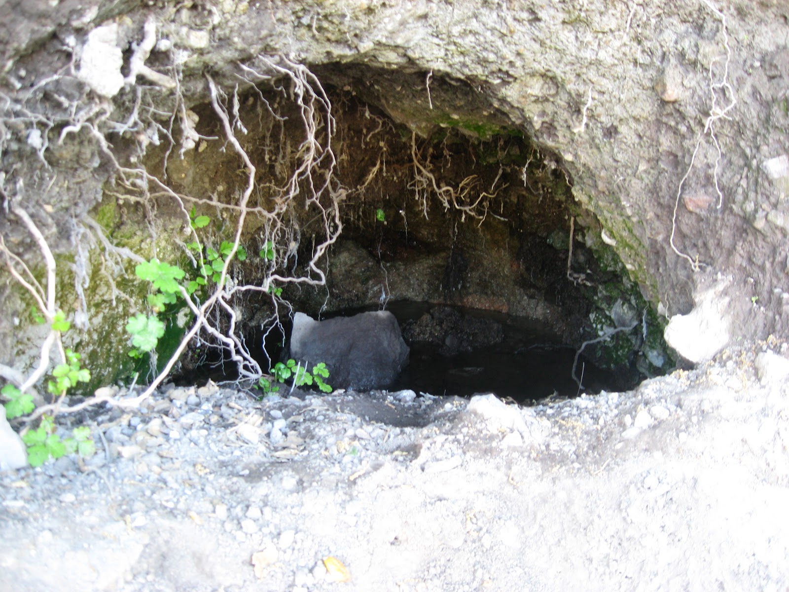
the miniature grotto

the loop as shown will get you in the range of 35 miles,
depending on how much zigging and zagging you choose to do
The Velo course series at the CLR Effect is a continuation of the My Favorite Routes series that I did at the Claremont Cyclist. It describes various regular routes, or interesting irregular ones, that I ride now, mixed together with routes I rode while living in different areas of Southern California in the past.
Comments
Post a Comment