The Other End or, Why No Tracks?
There is the other end, and then there is the Other end. This was the other Other end, the east end of the Silver Fish Trail, the end I had been wanting to ride since my last trip to the west end. The end that was mostly a mystery beyond a heavy steel Forest Service crash gate that I had passed countless times while riding up Highway 39. The end that old topo maps call a road, but in reality bears no similarity to any such thing.

Amazing. Comparable to Monroe Truck Trail, and maybe some of the trails in the Pasadena / Altadena area around Brown Mtn and Mt. Lowe. From the moment you ride around the gate, and for as far up canyon as I happened to ride it this morning, the east end of the Silver Fish plastered a single track grin across the bottom of my face. Honestly I was not expecting this. The trail, also carrying the designation of Forest Service road 2N28, is pure trail riding; old maps show the opening portion off of Highway 39 to be dirt road. If it was in the past, it certainly is not now.
Being so close to the city, and with Encanto Park (from which I started) just some five miles down canyon, you would think this trail would be well known and well ridden by mountain bikers. Instead, I was shocked that my tracks were the only ones left in the dirt. Is it because mtbers don't like riding on the road to get to the trail? Is it because they don't trust leaving their vehicles unattended at mountain road turnouts (understandable since break-ins frequently occur at such places)? Is it because the trail is an out and back, rather than a loop? Or is it because they simple don't know about it? Clearly someone uses the trail, otherwise the brush would have encroached and crowded it out long ago. But who? I have said it before, and I will say it again, the Silver Fish has the potential to be a great trail riding experience.
That said, I didn't go as far in as I would have liked; the Ibis is just not geared right now for sustained climbing on the dirt. Next time I will be on the mountain bike - I suspect for just about everyone, this is new dirt - who else wants in?

Apparently I have not ridden here in a while. The solar-powered bollards / path lights are new to me, and a very cool addition. Unfortunately idiots have already taken to lighted tops off at least one that I noticed.

fortunately, as is usually the case, evidence of human activity becomes less observable the further away you get from the paved road

just beginning to climb

Morris Reservoir and the old Naval Weapons testing ramp

gentle turns

single tracking

mmmmm, mmmmmm, mmmmmmm

little rock slide to walk around
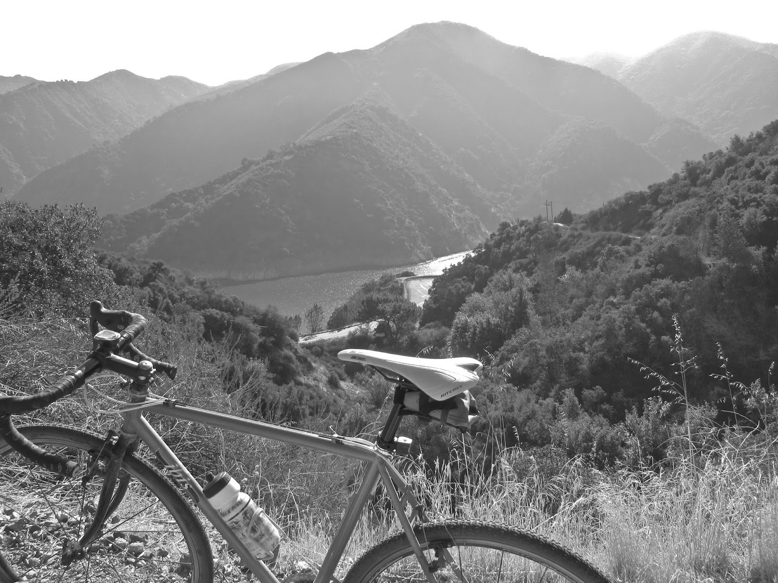
little bit higher, another view of the silvery waters of Morris

why yes, I suppose you could try tightrope walking - the power line is that close

a little bit higher Morris Dam comes into view

gentle turns. around the bend the trail heads up Water Canyon, at the head of which is a spring and the trails' first switchback

shade from the canyon wall

Water Canyon

heading back down. so good

autumnal leaves

the east end. if you can read topo maps this one notes that the portion between Highway 39 and right about the 2400 foot contour is road, beyond that becoming trail. maybe once upon a time that was true
Comments
Post a Comment