More Gravel Ride Discoveries

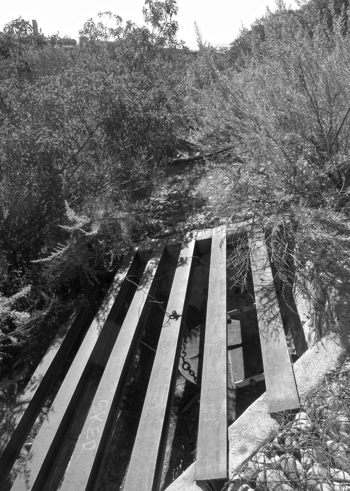
June 11, 1928. I knew a lot of the "water works" in the San Antonio wash were probably pretty old, but I was still surprised to find evidence of just how long ago they were constructed. Construction of San Antonio Dam began in 1952 and was finished in 1956, so the various water diversion channels and gates predate the dam by more than twenty-five years and thus, when they were built, there would have been water flowing for much of the year, along with a need to control and direct that flow.
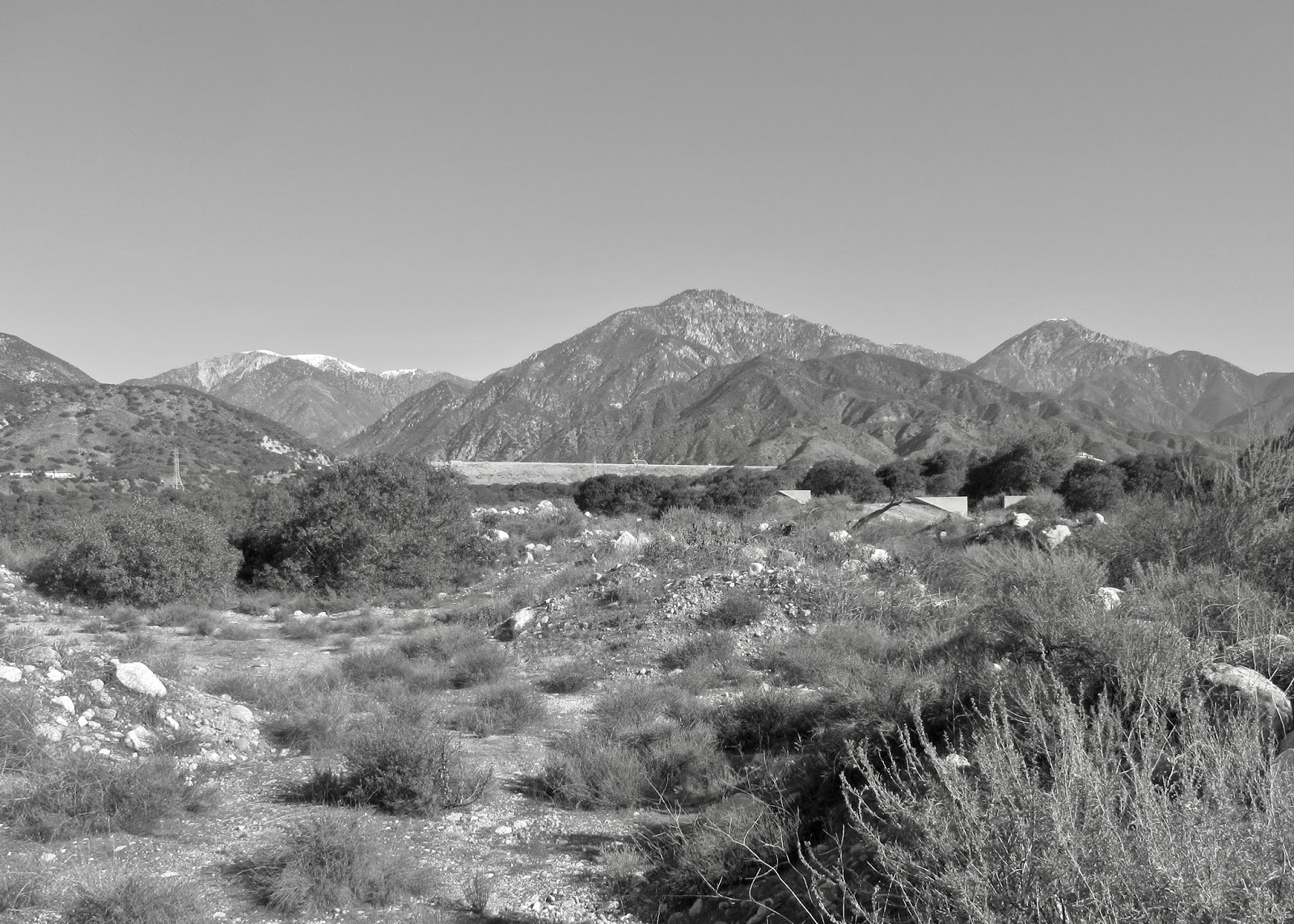
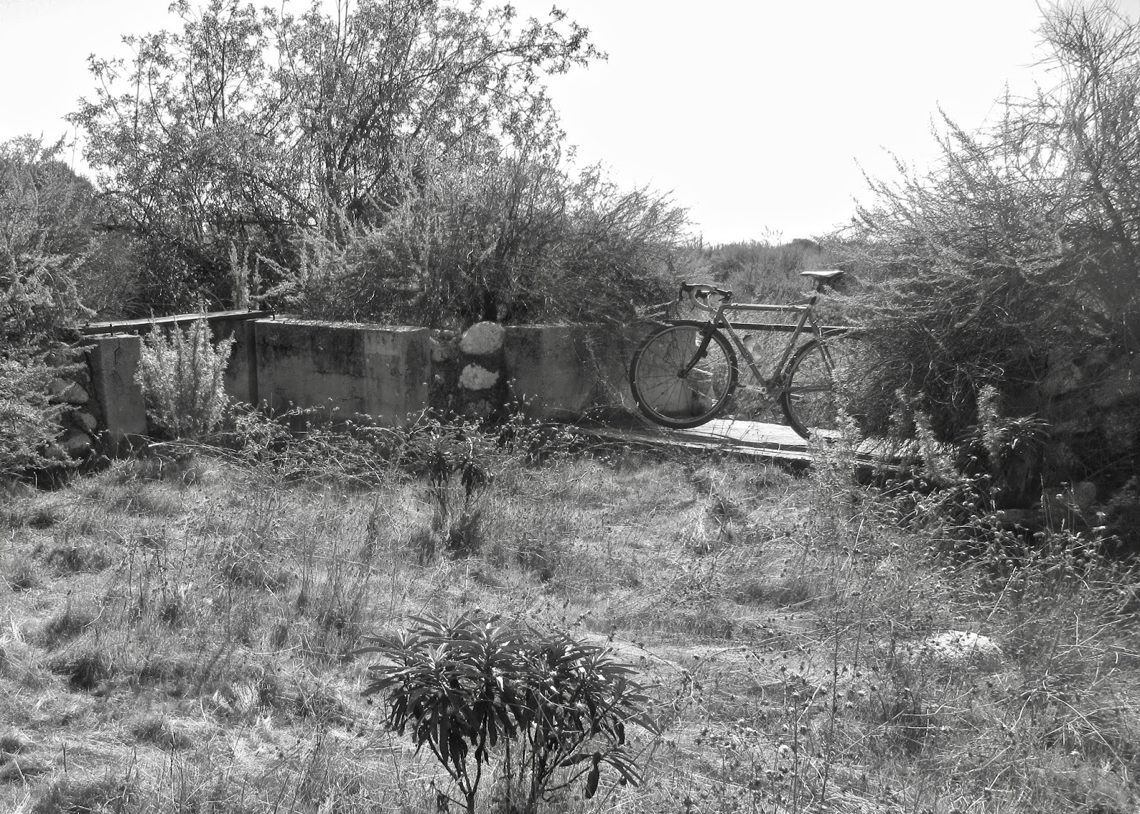
By the late 1920s Claremont's citrus groves were producing more than two million crates of produce (Hackenberger, Benjamin C., 2015). Water to sustain all that agriculture would have come from wells, and from San Antonio Creek, which drainage would have included the slopes of Mt. Baldy, Icehouse and San Antonio Canyons. Getting the water from these mountain sources to users in the valley below was, and has always been, the key. Of course the concrete headwalls and ditches leading to them upstream, and from, and between others, downstream would themselves have been predated by even earlier structures - I would not be surprised if some of the simple stone wall in the wash date to an ever earlier period.
-*-
I awoke Sunday morning not sure what the day's ride would be. While the paper got read, my coffee got cold, and the morning news programs came to an end, I realized I had to continue the theme of "discovery" that had begun with a reconnaissance of Draw #1 on Friday afternoon, and then continued on Saturday with some 1950s Pomona. No one said that discoveries had to be myth-shattering, earth-shaking or life-saving. I figure they could be small, like simply finding something new in the neighborhood.
-*-
Some interesting things I noticed while photographing the water control and diversion structures shown here: Typical construction seemed to pair a wider un-gated "spillway" with a gated headwall alongside. These structures often, though not always, seemed to be located on the downstream side of small basins. My assumption is that water could fill the basin, overflow through the spill way along the main stream channel, while the gate (a little lower than the spillway) could be opened allowing water into side channels. The question I had was, did the gates open directly to irrigation ditches and agricultural fields, or something else.
The answer, I now think, lies with the Pomona Valley Protective Association. The PVPA was organized in 1910, and their original mission was to recharge the ground water for agricultural use. Thus, the various small channels, gates, etc may actually be the remains of early methods of moving water from one recharge basin to others, and in that way fulfilling the organization's directive. Interestingly, I don't believe the original mission of allowing groundwater recharge has changed much. Though the downstream user, agriculture, has dwindled, recharge is still important for the hundreds of thousands of people who call the Pomona Valley home. Even underground water continues to move downhill, to the lowest portion of the valley, the Prado Basin.
The construction of San Antonio Dam would have rendered all of the structures moot, but I wonder two things - how long were they used for the purpose to which they were constructed, and why were they not all washed away in the great flood of 1938?


Comments
Post a Comment