Shoemaker Canyon Road and the Red Scare

blurred, I know, but I wanted to show the effort someone put into adhering individual small tiles to the tunnel wall. You can't really notice it in this view, but some unfortunate soul spray painted a big HATE on the wall over the tile work. Love wins.
I am destroyed. I weigh ten pounds less than I did at the mornings first downward push of the right pedal. The spinal compression of being hunched in the saddle, for 5.5 nearly non-stop hours, means I am a good inch or two shorter than I was when I rounded the first corner away from home. Words leave my mouth slow and deliberate, each sylable requiring thought. Normal speech is not possible, it requires too much effort. When within a mile of home, both legs began to cramp - top, bottom, front, back, gastrocnemius, soleus, Achilles tendon, m. vastus mediais, m. vastus lateralis, m. sartorius, rectus femoris, bicep femoris, you name it - they were ready to go on system-wide strike. Fortunately, they lasted that long. I could use a word like cooked, burnt, fried, wasted but, destroyed seems more apt right now.
But enough of that nonsense - the most satisfying things in life are those that require the most effort. After riding the East Fork Loop on Tuesday of a couple weeks ago, I stewed in my juices, waiting for the chance to get back up there to add the Shoemaker Canyon out-and-back onto the route. A little bit impetuous, I suppose, but I had this need to get back up there. The sooner, the better. When you branch off the East Fork Road, to start up Shoemaker Canyon you have about two miles of pavement riding in front of you. At the end of that two miles is a parking area and the ubiquitous yellow gate barring the way to any further motor vehicle passage. The next mile and three quarters or so takes you on a mostly hard packed dirt and rock surface. There was one steep, loose section that I walked, or more accurately hobbled up (road cleats), but for the most part, and surprisingly, there is very little loose material on this road so, even on a road bike as I was, it is almost entirely rideable. Three and a half to three and three quarters from the Shoemaker turn-off, you reach the first tunnel. The second tunnel is a relatively short distance beyond, but on this long hot (computer read 90º) day, when I still had to tackle the back side of GMR, I decided enough was enough. I saw the tunnels, and rode to one, that was my goal for the day.
So, what does Shoemaker Canyon Road have to do with the Red Scare? You will notice the date on the first tunnel keystone (obviously more a symbolic keystone than a structural one). The date of the first tunnel is 1961 - right in the middle of the Cold War. The story is that Shoemaker Canyon Road and its two, completed, tunnels were envisioned to serve as an escape route for people of the Los Angeles basin in case of a nuclear attack. Yes this little ribbon of pavement would funnel tens of thousands of vehicles in a matter of hours at best through some of the most rugged canyons of the San Gabriel Mountains. Good plan, yes? No. It must rank up there with backyard bomb shelters and the good old duck and cover that was practiced by students at all the regional schools. Anyway, the difficult terrain, and the heavy expense of attempting to push through that terrain, doomed the project to failure and left us with what we see today. The Road to Nowhere. Incidentally, the infamous Bridge to Nowhere, is a mere minutes crow flight away.
So, what did the Shoemaker Canyon Road extra add to the East Fork Loop? I got an extra 7 miles, and between 900 and 1000 feet more of elevation gain. Beside the physical addition though, and perhaps more significant, is an intangible, a connection to history.

In the Velo course: East Fork Loop I showed these stone retaining walls, built in 1962, from across the canyon.
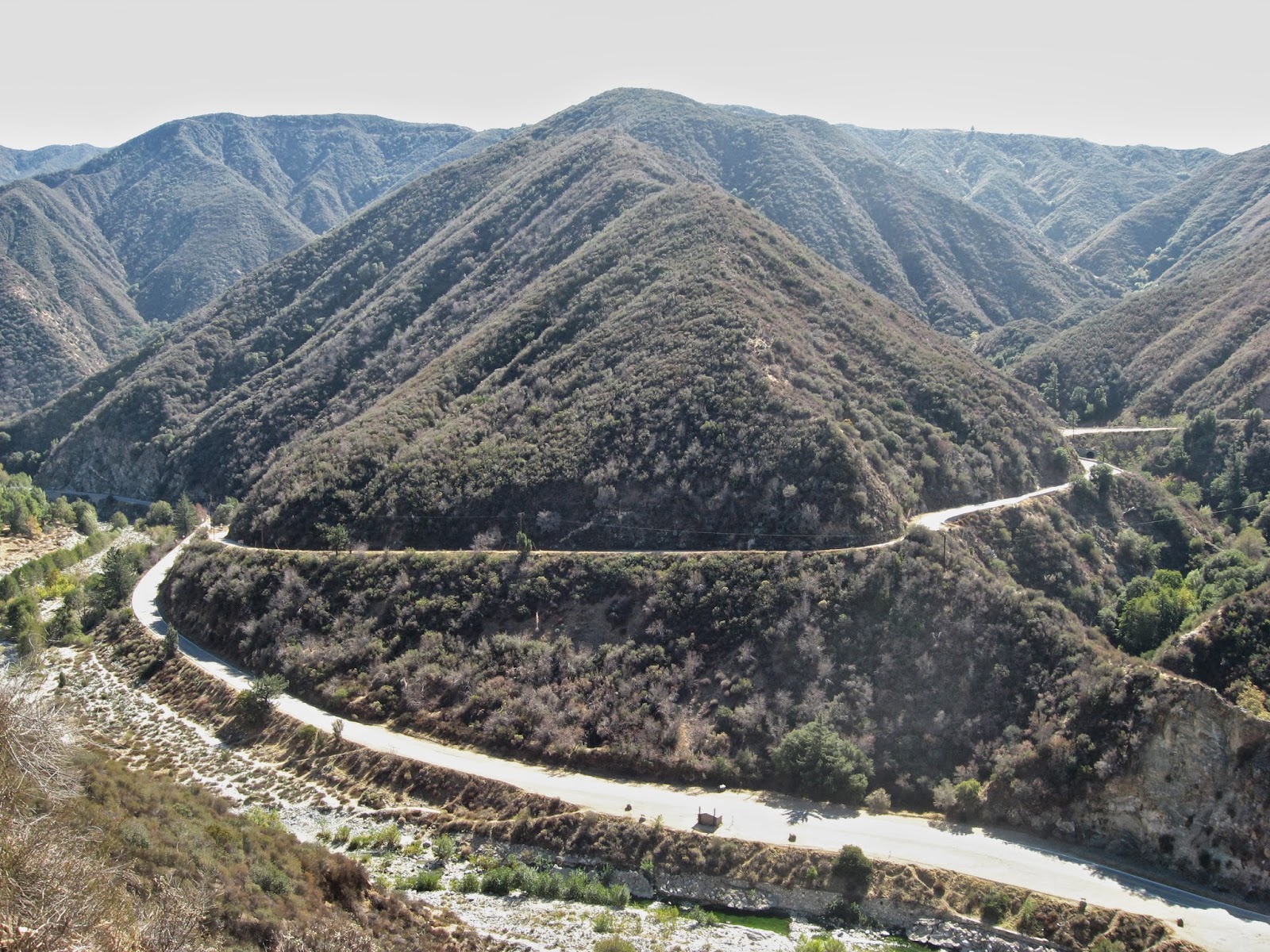
The forks - East Fork Road along the river, Glendora Mountain Road beginning its rise

Fire denuded mountainsides along the dirt portion of Shoemaker.

The tunnels - the first tunnel is obvious (I hope), but can you spot the second? Follow the closest ridgeline, the one through which the tunnel passes, down. Right over that ridge line and just before you get to those green yuccas on the right, there is a light grey splotch with a black circular speck - that is the top of tunnel #2.

Deep canyons, and the inevitable view of Mt. Baldy rising in the distance.

Entry portal

The length of tunnel #1, partly ribbed, partly exposed stone.

Another interior shot from further in, with flash.

Check out the rifling on that gun barrel!
ReplyDelete